Flight over Black Canyon of the Gunnion, 1975
Some text courtesy of statebridge.com.
Edited by David Barth January 2016. Photos were taken by David Barth.
 |
| Crossing Monarch Pass and looking into South Park. |
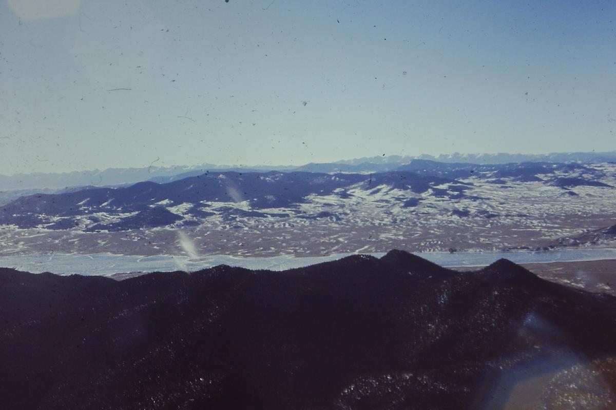 |
Crossing Monarch Pass and looking into
South Park and an ice-covered reservoir. |
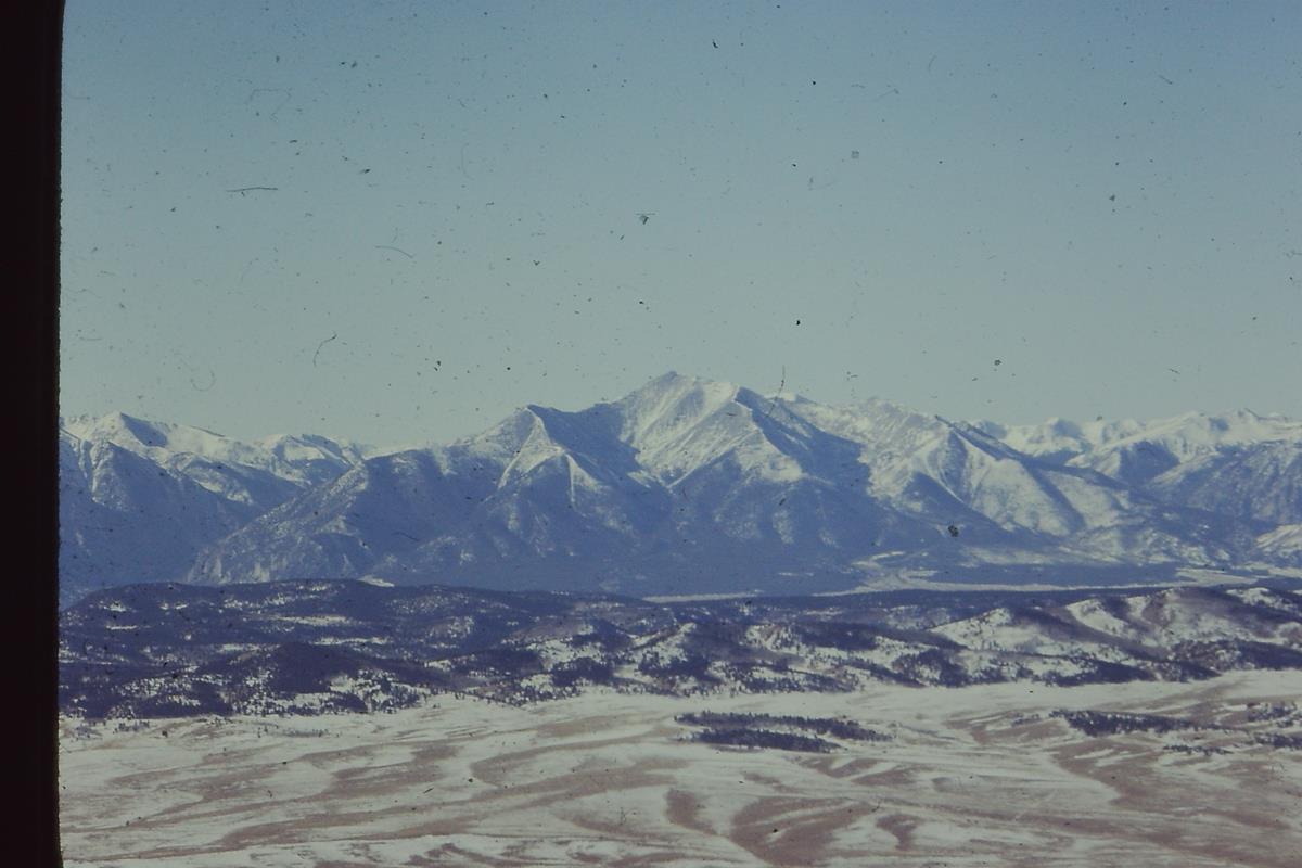 |
| Mt. Princeton, a Colorado Fourteener (over 14,000 feet). |
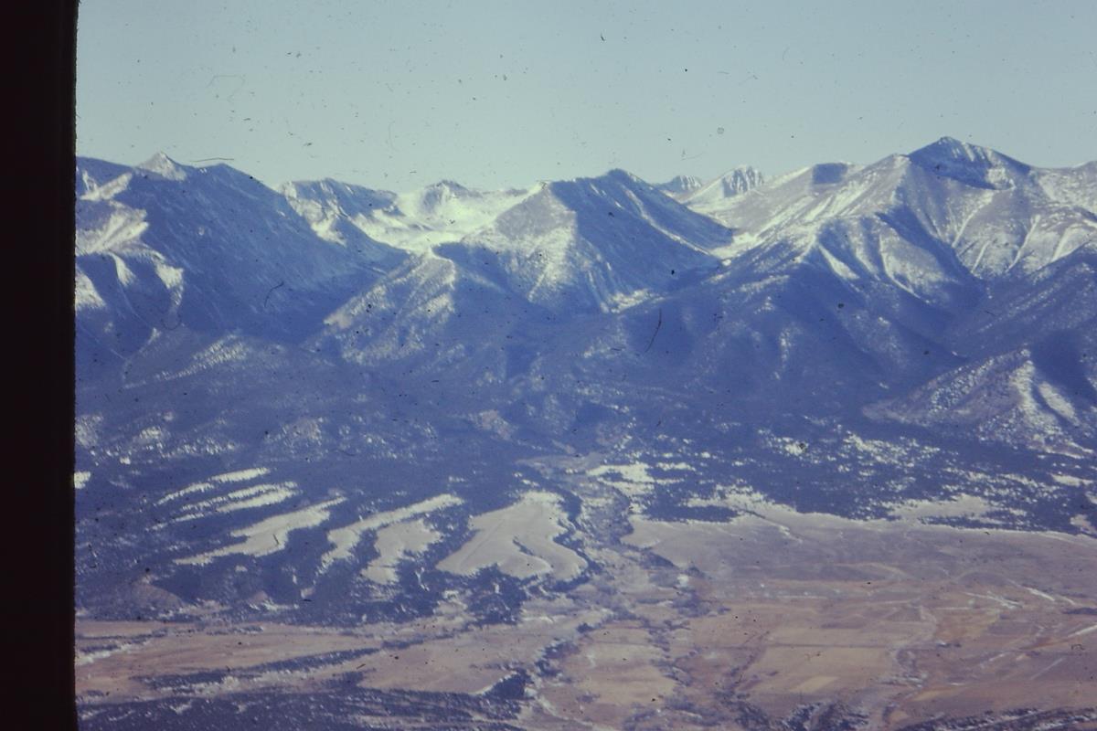 |
Center: Mt. Shavano and Mt. Tabagachue, with a
shallow ridge between them.
Both are Colorado Fourteeners (over 14,000 feet). |
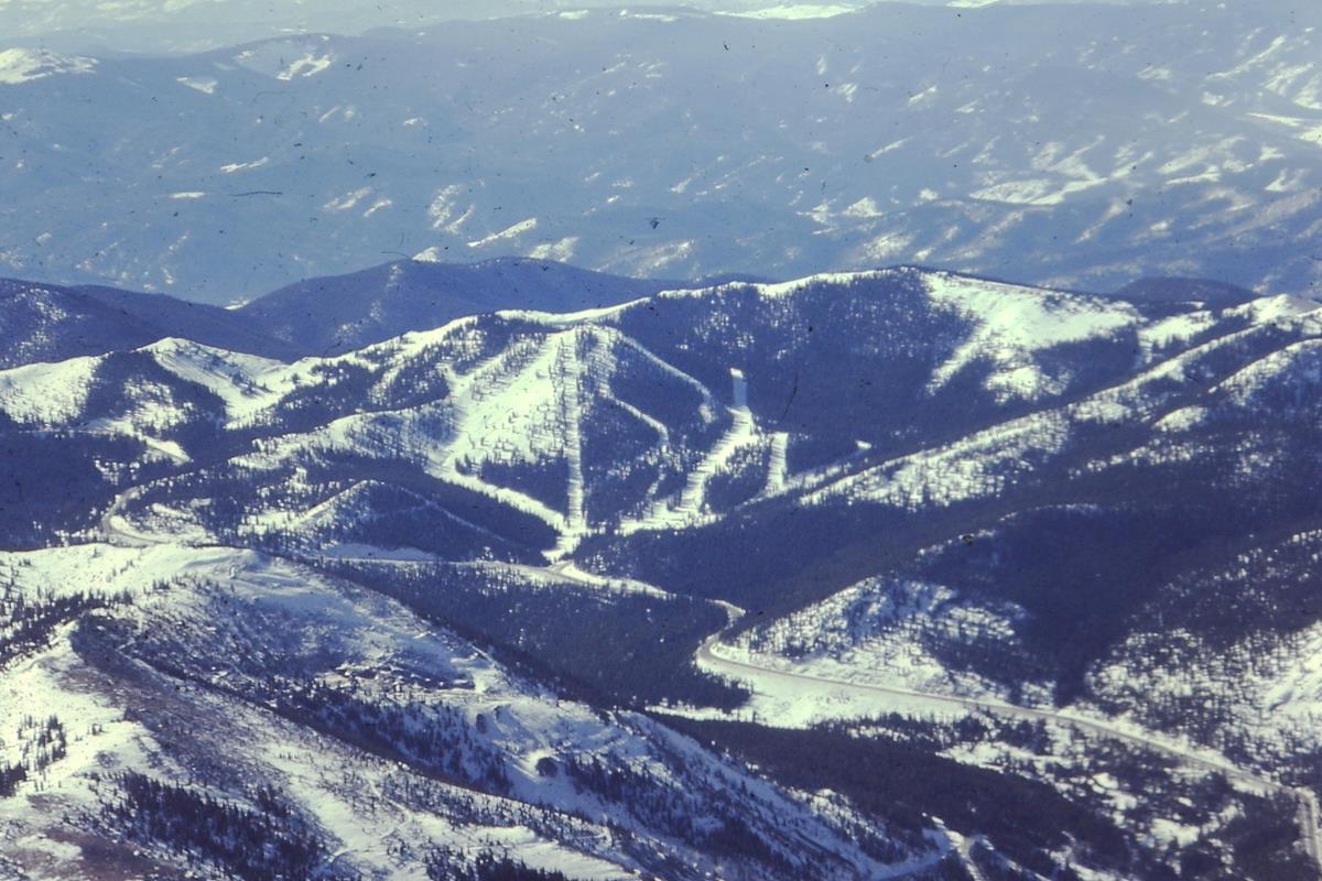 |
| The road crossing Monarch Pass and Monarch Pass ski Area. |
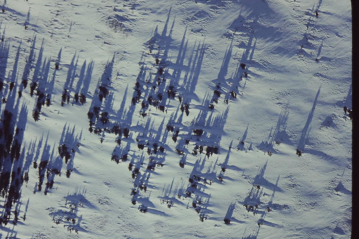 |
| Tree shadows as the sun sets behind a mountain. |
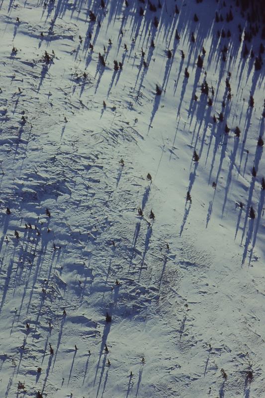 |
| Tree shadows as the sun sets behind a mountain. |
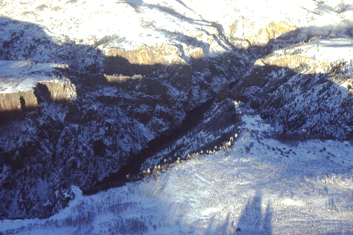 |
| Black Canyon of the Gunnison. |
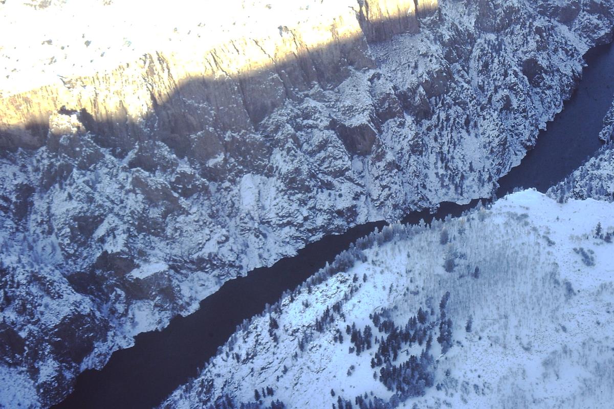 |
| Black Canyon of the Gunnison. |
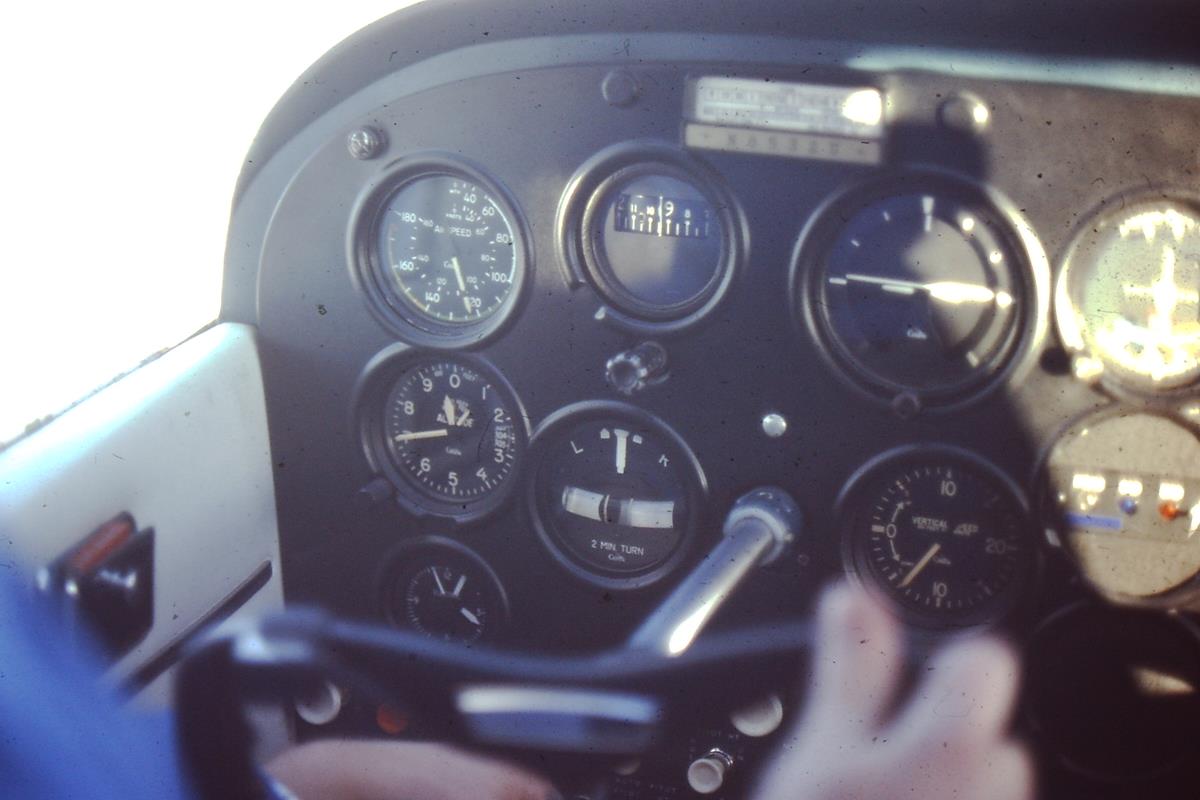 |
| Cessna 172 panel with the altimeter, upper left, showing 9,700 feet altitude. |
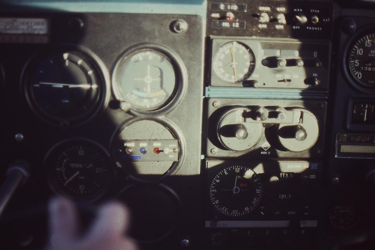 |
| Cessna 172 radio stack, right of center. |
 |
| Steam rising from Colorado River. |
 |
| Steam rising from Colorado River. |
 |
| Steam rising from Colorado River. |
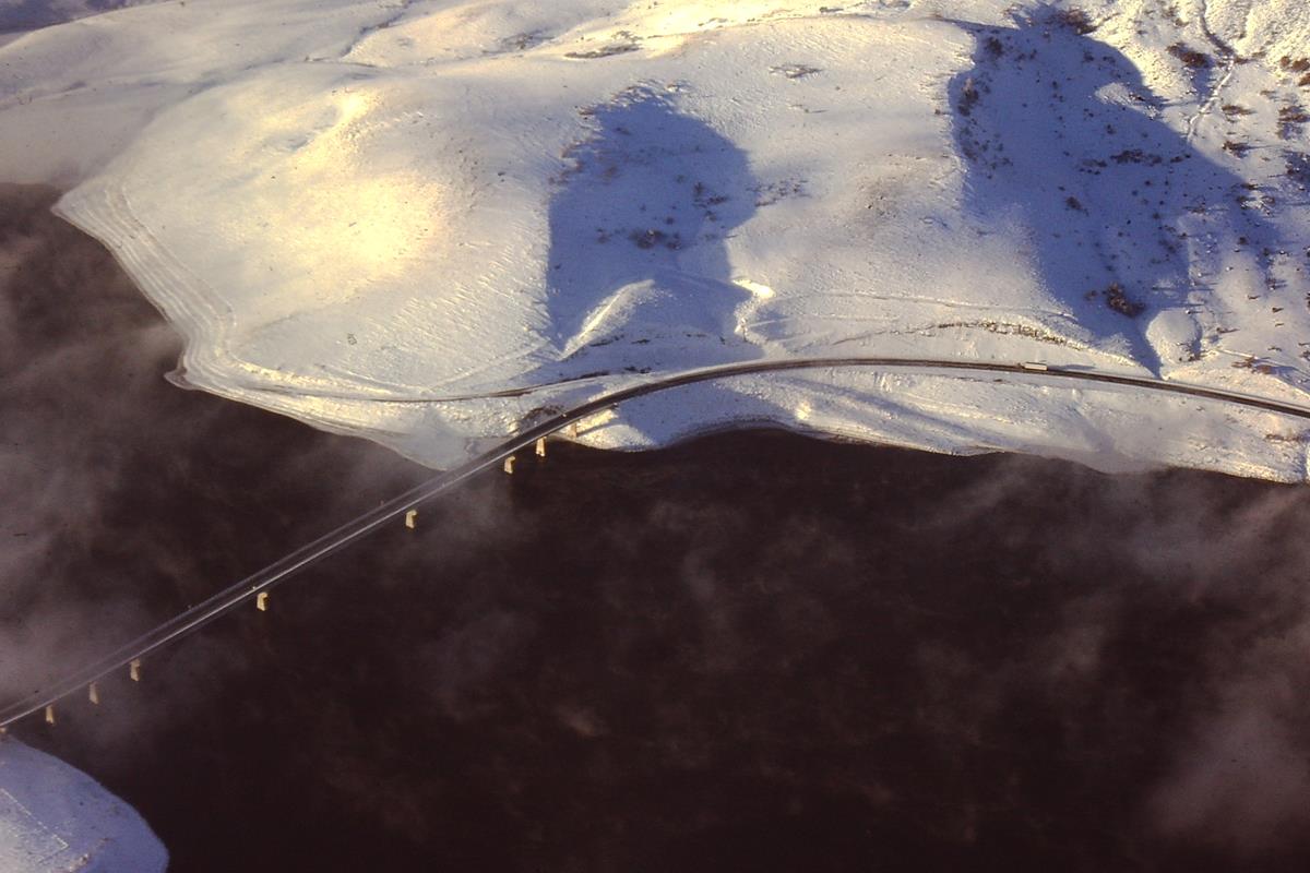 |
| State Bridge crossing the Colorado River. |
Recent archaeological work near State Bridge has shown that prehistoric people occupied the area as far back as 8,000 years ago and that the Ute Indians inhabited and used this area as recently as the last 1000 years. Chief Yarmony is the most famous of the Ute Indians from this area and it is for him that Yarmony Mountain (behind the Lodge) was named. Legend has it that the Chief is buried atop his namesake mountain and if you look carefully while floating by Rancho Del Rio, you can see his silhouette laying in repose.
At the end of the 19th Century, when the Silver Boom ended, former miners from Leadville started migrating to the area for the warmer climate and proximity to the Colorado river (formerly called the Grand River). These new cattle and sheep ranchers needed supplies from Wolcott, which was the closest railroad stop at the time and Trough Road (just in front of the State Bridge Lodge) became a wagon trail.
The only way across the river at the time was a ferry that was used by the pioneers, settlers and visitor's from all over the country en route to Steamboat. State Bridge was a stagecoach stopping station on this route. The land on which the State Bridge cabins now sit was originally purchased as a mining claim around 1880 but was never really mined. In 1890 the State of Colorado authorized $6,000 for the construction of a wagon bridge over the Grand River (now called the Colorado River). The Missouri Valley Bridge and Iron Works Company got the contract for their bid of $5790 and built the two span Howe Truss bridge whose remnants can still be seen out front. This was the first State of Colorado grant to build a public bridge and it is how "State Bridge" got its name.
In 1860 David Holliday Moffat came to Colorado from the banking industry in Omaha, Nebraska and worked among businessmen and miners in Denver to form a bank. Moffat was involved in nearly every railroad scheme from the Colorado Central to the Rio Grande. The rail that runs directly in front of the State Bridge Lodge was built in 1905 as a part of Moffat's projects and Union Pacific rail workers today still refer to this stretch as the Moffat Tunnel subdivision. The first major road from Denver to Craig, Colorado was named the Moffat Road and was first organized as the Denver, Northwestern and Pacific Railroad in 1902.
The need to get cattle and sheep to the market spurred the development of a rail station at State Bridge in 1905 as well as the acquisition of land between the rail and the river. This area was used by the railroad as a stockyard for the cattle. In 1913 the company was re-organized as The Denver & Salt Lake Railroad (D&SLR), two years after David Moffat's death. Another chapter in local rail history was written in 1932 when the Denver and Rio Grande Railroad bought out the D&SLR, then completed the "Dotsero Cutoff" from Bond to the existing D&RG line near the confluence of the Eagle & Colorado Rivers in 1934. In the next few decades coal became the main job for the rail with the development of the Yampa Valley coalmines. To this day coal is the major customer of the rail lines in front of State Bridge. Other customers include the Amtrak passenger and freight industries. About 10 to 15 trains a day pass by State Bridge [from the text found on statebridge.com in 2016].
It was during these prosperous times of the early 1900's that hunters began flocking to the area for the abundant fish and elk. In 1901, then Vice-President Teddy Roosevelt stayed at the State Bridge Lodge (Cabin 3) while elk hunting in the nearby Flat Top Mountains. From the beginning, the lodge has always been some form of saloon, restaurant and always a great place for entertainment and fun! Native Americans, trappers, miners, railroad workers, pilgrims, pioneer, gamblers and cowboys and saloon girls occupied the area during the early years.
At the time of Prohibition, State Bridge served as a speakeasy and illegal gambling center. This continued until the authorities raided it and shut operations down. They also burned all the gaming tables on the hillside where the BLM now owns a campground. We [statebridge.com] are currently piecing together the history up to the 1980's when State Bridge became a popular rafting destination and off the beaten path recreation area. We have heard stories that the Lodge was home to a group of Mormons who operated an ice cream parlor during the 1970's before selling it to some hippies, who brought back the music and libations element. By the mid 1980's the word was getting out that State Bridge was a place to congregate outside the mainstream and a place that would become a nationally famous live music venue. From that time until the Lodge burned down in 2007, the place was a popular bar, grill, river recreation, and hunting destination and a place to catch rising music acts like The Dixie Chicks, Leftover Salmon, The String Cheese Incident, Peter Rowan, and many many more.
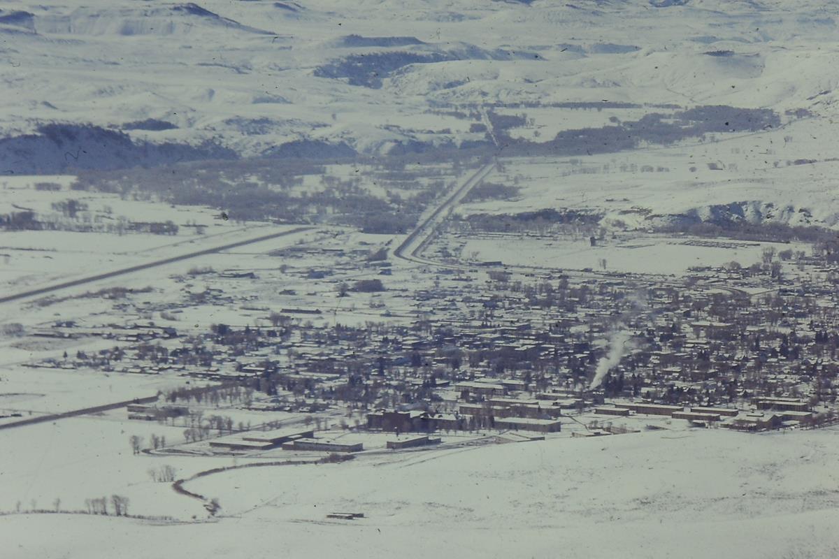
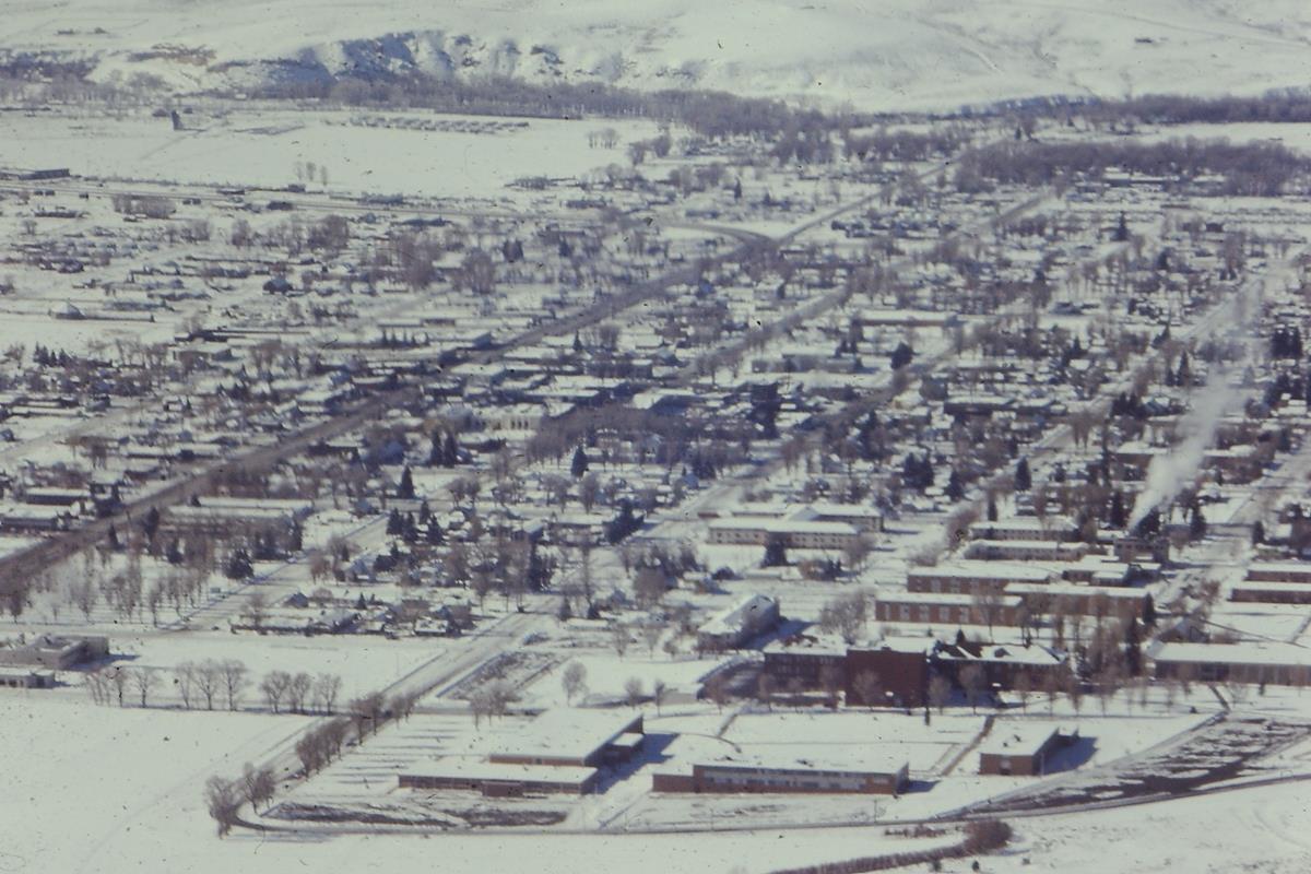 |
| Gunnison, Colorado. |
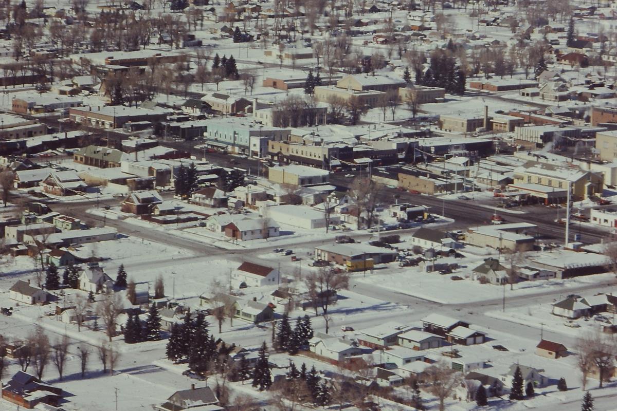 |
| Gunnison, Colorado. |
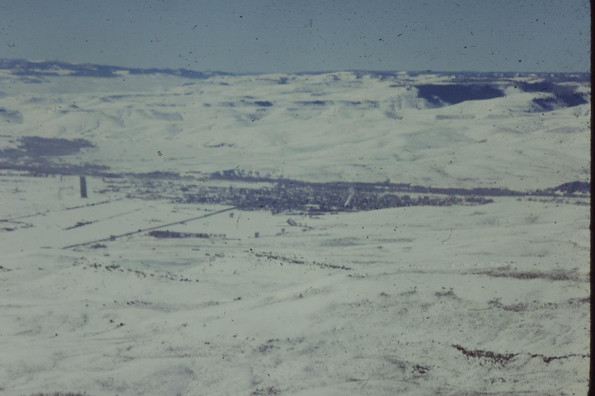 |
| Gunnison, Colorado. |
 |
| Gunnison, Colorado. |