| Home; Aviation; Cameras; Fiction; Health&Safety; Military; MS-Apps; Non-Fiction; Submarine; Technical; Trains; Watches; Transportation |
|---|
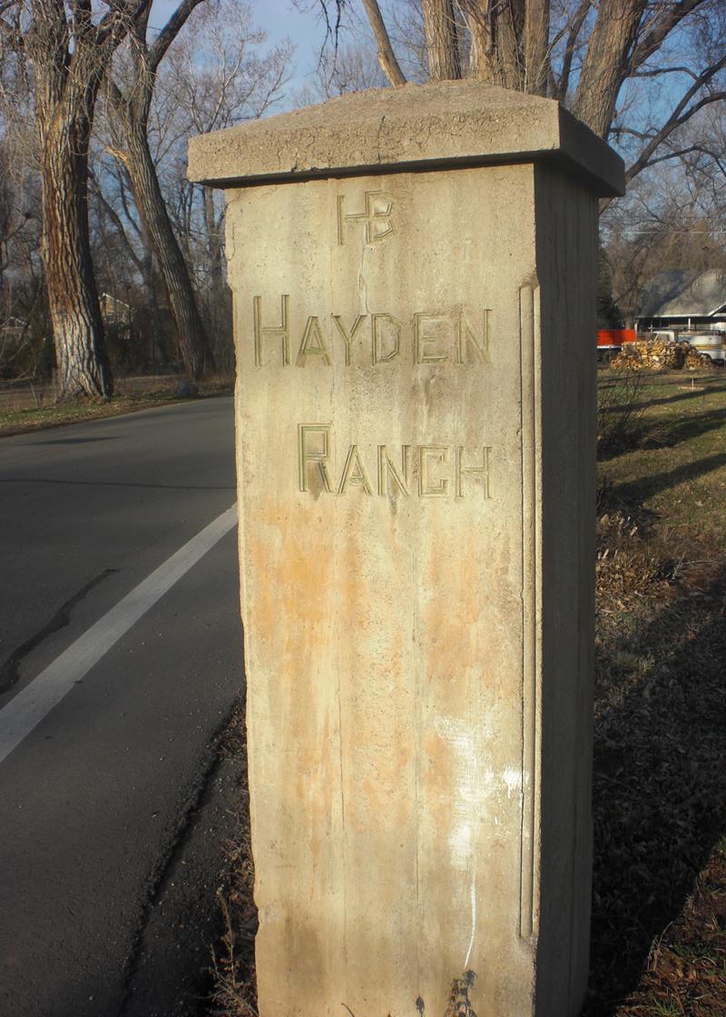
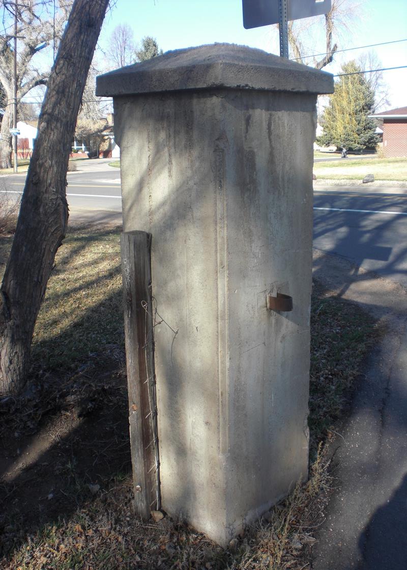
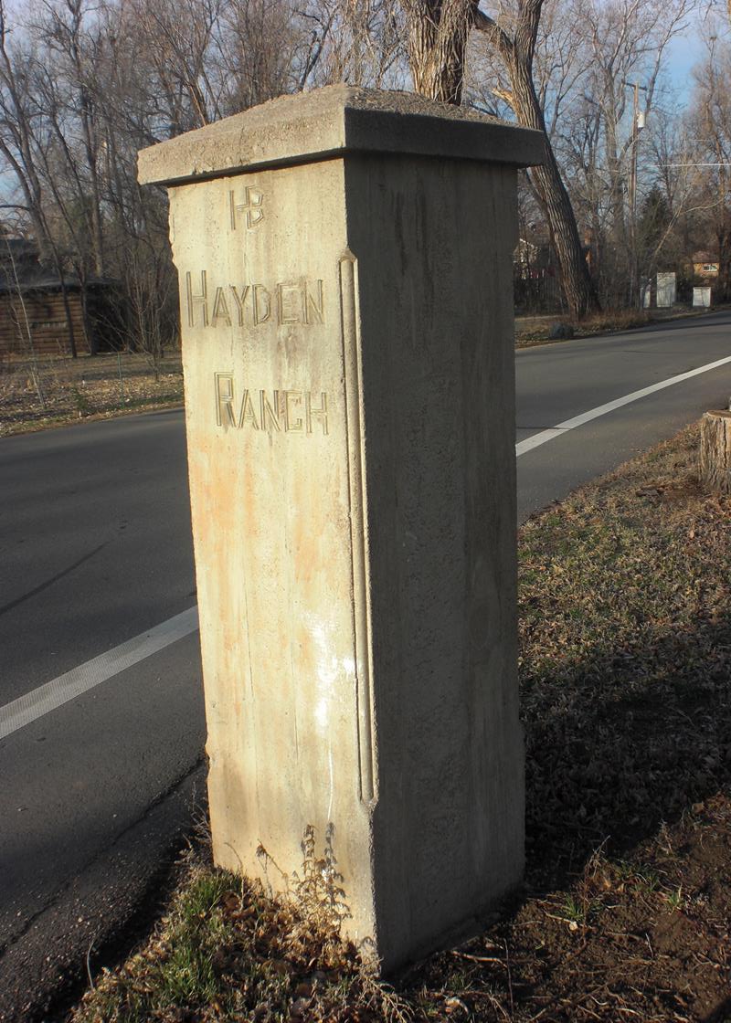
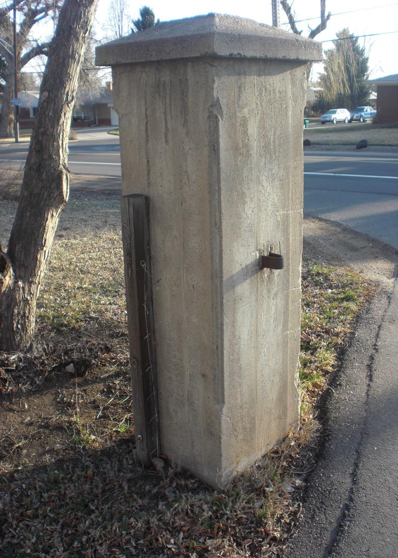
Hayden Ranch Marker, Lakewood, Colorado
Street view photo courtesy Google Earth.
Text courtesy of the Denver Federal Center Museum in Building 41, and GSA.
Edited by David Barth 1 April 2014. All other photos by David Barth.
 |
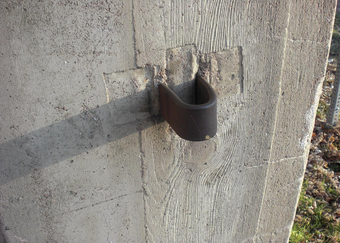
| Hayden Ranch Marker. |
 |
| Hayden Ranch Marker. |
 |
| Hayden Ranch Marker. |
 |
| Hayden Ranch Marker. |
 |
| Hayden Ranch Marker. |
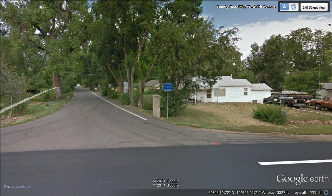 |
| Hayden Ranch Marker. Street View courtesy Google Earth. |
THE HAYDEN RANCH, 1913-1941
The Hayden ranch was founded in 1869 by Major Jacob Downing, organizer of the First Colorado Cavalry Company D during the Civil War. Downing built a 1,500 acre ranch to raise Arabian thoroughbred horses. The ranch also included cattle, fruit trees, and a large brick ranch house.
Downing died in 1907 and the ranch was purchased by Thomas Hayden's real estate firm in September 1912, two months after Hayden died. His heirs expanded the ranch to the southwest, as far as Rooney Road at the base of the hogback, to 6,300 acres, used primarily for cattle. Hayden's daughter-in-law, Mrs. St. Claire Hayden, continued to operate the ranch after the death of her husband, William, in 1937. By 1940, the 7,000 acre Hayden ranch was the largest livestock operation in the Denver area.
The entrance to the ranch was at West 4th Avenue and Garrison Street. One of the gate posts still stands with the HB brand of the Hayden Brothers.
During this time, Lakewood consisted primarily of farms, dairies, orchards, and ranches. It appeared likely that the United States would be drawn into the war in Europe. As a result, the federal government began building new munitions plants to support the military buildup. The Denver Chamber of Commerce, railroads, newspapers, and various civic organizations began lobbying for Colorado to be the location of one of these four plants. The large size and lack of inhabitants in the Hayden ranch area was attractive to the War Department.
In January, 1941, the federal government purchased 2,072 acres of land from three different landowners, the majority from the Hayden ranch, and began to construct the Denver Ordnance Plant.
| LAKEWOOD HISTORICAL SOCIETY SITES | ||||
|---|---|---|---|---|
| NUMBER KEY | IDENTIFICATION | ADDRESS | YEAR BUILT | REGISTRY |
| 1 | Cason Howell House | 1575 Kipling Street | 1874 | State Registry |
| 2 | Washington Heights School | 6375 West First Street | 1889 | State Registry |
| 3 | Stone House | 2900 South Estes Street | 1886 | National Registry |
| 4 | Peterson House | 801 South Yarrow | 1880 | National Registry |
| 5 | Davies Chuck Wagon Diner | 9495 West Colfax Avenue | 1957 | National Registry |
| 6 | Schupp House | 1275 Ames Street | 1908 | |
| 7 | Ward House | 2261 Estes Street | 1928 | |
| 8 | WWII Memorial Monument | 7655 West 10th Street | 1947 | |
| 9 | Golden Hill Cemetery - Hill | 12000 West Colfax Avenue | 1908 | National Registry |
| 10 | Mercy Grove House | 1980 Garland Street | 1935 | |
| 11 | Cline House | 7020 West 13th Street | 1939 | |
| 12 | Rose Cottage | 1800 Dover Street | 1918 | |
| 13 | Panoramic Park | 12655 West Colfax Avenue | 1961 | |
| 14 | Addenbrooke Fireplace | 9100 West Center Avenue | 1953 | |
| 15 | Isaac Solomon Synagogue | 1600 Pierce Street | 1904 | |
| 16 | Schnell Farm | 3113 South Wadsworth Boulevard | 1888 | National Registry |
| 17 | O'Kane House | 6795 West First Street | 1897 | |
| 18 | Kellogg House | 2080 Klein Street | 1888 | |
| 19 | Everett Farm | 300 South Garrison Street | 1922 | |
| 20 | Denver & Intermountain Car 25 | 500 Kipling Street (Federal Center) | 1911 | State Registry |
| 21 | Mile High Church | 9079 West Alameda Avenue | 1973 | |
| 22 | Heavenly Paradise House | 975 Reed Street | 1952 | |
| A | Building 710 (Federal Center) | 10000 West Alameda Avenue | 1960 | National Registry |
| B | FEMA Building | 10000 West Alameda Avenue | 1969 | National Registry |
| C | JCRS Historic District | 1900 Pierce Street | 1900 | National Registry |
| D | Bonfil-Stanton Outbuildings | 797 South Wadsworth Boulevard | 1920 | State Registry |
| E | Country Club Garden Apartments | 1160 Pierce Street | 1962 | State Registry |